Diamond Creek Falls
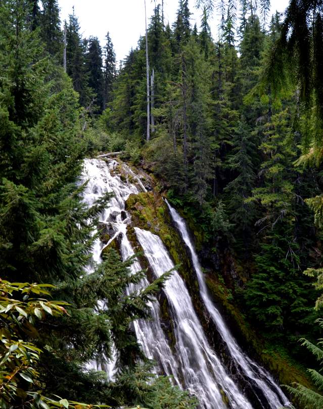
Diamond Creek Falls is located near Oakridge - Westfir in the Cascade Mountains. Your steep hike down is rewarded with a close up experience of the waterfall.
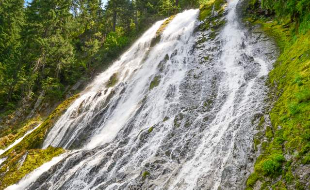
- A glittering fan of water glistens over a 90 foot (27.432 m) drop, then falls an additional 500 feet (152.40 m) over a series of tiers considered the Lower Falls.
- The 3.2 mile (5.1499 km) loop trail skirts the rims of the Salt Creek and Diamond Creek Canyons, passing the lower falls first and continuing to the upper falls where Diamond Creek spills over. Halfway through the hike a side trail descends to the base of the upper falls for a dramatic look up.
- On this hike it's possible to touch the water as it sprays down. Remember to use caution climbing over the giant boulders and loose stones and always be aware that rocks and debris may come over the falls.
- In the spring the forest is even more vibrant with blooming rhododendrons.
Know Before You Go
- Access to the Diamond Creek Falls trailhead is from Salt Creek Falls Observation Site's parking lot
- Mosquitoes may be pesky in the spring
- Willamette National Forest - Middle Fork Ranger District
- Day Use Fee Area ($5 a vehicle) or Recreation Pass required. Permits may be purchased at the Visitor Center in downtown Eugene.
- Facilities are closed in winter
- Adjacent the Salt Creek Sno-Park in winter
- Connects to Vivian Lake Trail #3662
Directions: Diamond Creek Falls is 23 miles (37.015 km) southeast of Oakridge and approximately 5 miles (8.0467 km) west of Willamette Pass. From Hwy 58 look for signs to Salt Creek Falls, turn onto FS Road 5893 and follow the Salt Creek signs. Diamond Creek Falls is accessed here.
Get close to the Diamond Creek waterfall after a moderate but steep hike in. The veiled Diamond Creek Falls drops 70 - 90 feet (21,3 - 27,4 m), while the tiered Lower Falls drops 200 feet…
Nearby Attractions
Nearby Lodging
See Three Waterfalls on One Hike Near Oakridge
If you are a waterfall enthusiast, here is an outstanding waterfall hike which delivers three…
Best Winter Waterfalls
Sure, they're easy to visit in the summer – but intrepid road trippers who bundle up and…
